Emergency Action Plan Outreach Campaign |
|
|---|---|
Dam Emergency Action Plans (EAP)The District is developing plans with local public safety agencies to respond to the extremely unlikely event of a dam failure. In such an event, evacuation warnings and instructions will come from the emergency response agencies in your area, such as police and fire departments or the Fresno County Sheriff’s Department. To learn more about how the District’s inundation maps are prepared, please visit the District’s Dam Safety and Preparedness Site. You may have received a brochure regarding our Emergency Action Plan Outreach Campaign! If you have any questions at all, please feel free to call at (559) 628-DAMS (3267), or submit written questions here! |
 |
ADOPTED 2023/2024 BUDGET
ADOPTED 5 YEAR FINANCIAL FORECAST FOR 2023/2024 – 2027/2028
About Fresno Metropolitan Flood Control District
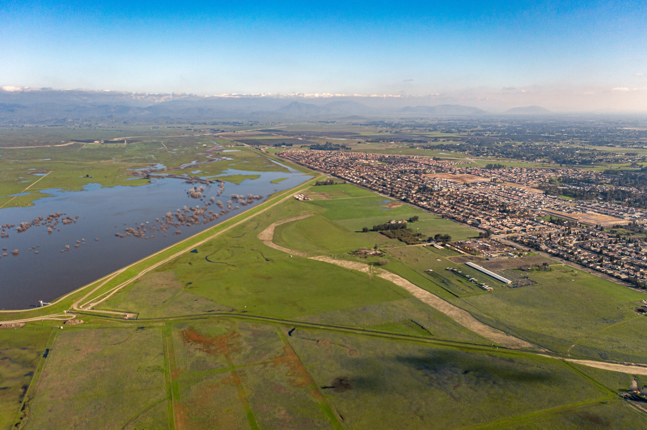
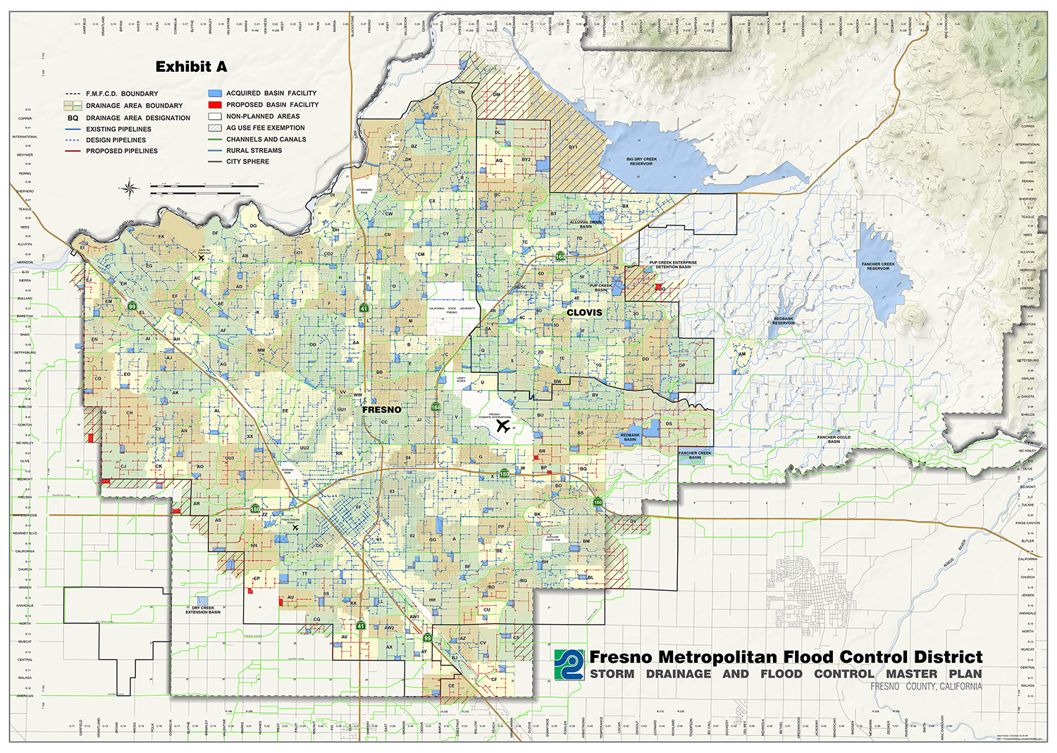
The Fresno Metropolitan Flood Control District provides flood control and urban stormwater services in a 399-square mile watershed located between the Kings and San Joaquin Rivers. The District is home to more than 700,000 people and includes both urban and agricultural land uses. The Fresno/Clovis urban area is protected by 3 dams and seven large detention basins, and is served by a system of more than 700 miles of pipeline and more than 150 stormwater retention basins. Nearly 100 basins are connected to the Fresno Irrigation District canal system to allow for dry season groundwater recharge, producing an annual average of more than 45,000 acre-feet of recharge. In addition, more than 20 stormwater basins are also developed for recreation use.
Capital facilities are funded through local development fees and operations are funded through a limited voter-authorized tax. The District also provides Clean Water Act compliance assistance to businesses and industries that are subject to stormwater-related regulations.
To learn more about the District, read the overview brochure linked here, or view the 9-minute District explainer video (English, Spanish subtitles) featuring system footage, old newspaper articles and video of flooding in the 1960’s, and more.
Our Vision
A completed system of stormwater management facilities providing multiple quality-of-life benefits to our community.
Our Mission
It is the purpose of the Fresno Metropolitan Flood Control District to control storm and other surface water flows:
- Preventing property damage, personal injury and inconvenience; and
- Managing such waters for long-term beneficial use within the District
District objectives shall be achieved through adherence to the following standards:
- Performance excellence by District employees and contractors; and
- Environmental and economic sensitivity; and
- Maximized public benefit through multiple use of District facilities
Board Meeting Calendar & Agendas
To see The District’s upcoming board meeting schedule and agendas, please click here.
About Special Districts |
|
|---|---|
| Special districts are the most common form of local government throughout the State of California. According to the State’s Little Hoover Commission, “…there are more than 4,500 special districts which operate airports, harbors, cemeteries, hospitals, libraries and parks, and provide fire-fighting and paramedic services, flood control and water delivery throughout California. Of those, 2,993 are independent special districts [like the Fresno Metropolitan Flood Control District] run by elected or appointed boards with assistance of professional staffs. In contrast, there are 58 counties and 482 cities, making special districts the most common form of government in California.” To learn more about what makes special districts so special, visit the California Special District Association’s ‘Districts Make The Difference’ website. | |
